In today’s connected world, leading nonprofits are using mapping solutions in five critical ways: better-targeted programs & services, fundraising, strategic planning, storytelling, and mobilizing activists and advocates.
What is Digital Mapping?
You’ve already seen it. It starts with Google Maps but can be so much more. There are many sources of free data, like Federal Census Data, and state agencies that address and document health, education, poverty, and environmental issues. Then, there is organizational owned data, like where their programs are located or where their clients, donors, or volunteers are located. With the power of digital mapping, all these data sets can be layered one on top of the other and displayed in a map format. A digital map can provide a powerful visual representation of countless rows and columns of data in an interactive way.
Digital Mapping for Programs and Services.
Digital mapping offers a very practical benefit for targeting programs or services to areas where they are needed most.
Example: A Meals-on-Wheels nonprofit helps elderly residents in the community. They generate a list of residents and their addresses, excluding any that are known to be in the hospital or away from home. They use a simple and free online mapping service to display the addresses as points on a map. Finally, they plot the addresses so that they can most efficiently deliver the meals, saving time and fuel costs.
Digital Mapping for Advocacy & Activism
Mapping the issues also is a great way to present the case of support to busy people in the media, legislatures, and administrative agencies.
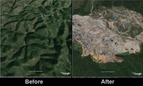
Example: an environmental advocacy organization is challenging the practice of mountaintop removal mining. In addition to containing news, multimedia, and social media tools, the nonprofit uses digital mapping showing the satellite photos of areas affected by mountaintop removal mining. They are not only demonstrating the extreme destruction to the mountain top but also the serious impact on the surrounding ecosystem.
Fundraising with Digital Mapping
Organizations are striving to effectively use more information about their donors while seeking to forge closer ties with others in their community. Digital mapping tools provide ways to better target these stakeholders.
Digital mapping tools also offer an excellent way to make a grant application quickly understandable to program officers in a powerful way.
Example: An advocacy nonprofit is raising funds to support water monitoring of a local creek system. It uses digital mapping to highlight the extent of the water system, like sources of contamination and critical monitoring point. They use this data in a presentation to their major donors, foundations and community members who would now be inspired to become supporters. Learn more ways about how to use digital mapping for fundraising.
Being a Data-Driven Nonprofit Strategist
An evidence-based approach is critical for the development of an actionable and relevant nonprofit strategy. Mapping allows the executive team and board to learn more about the communities and causes they serve.
Example: Social and economic inequalities in American cities in “booming cities” are growing. All have neighborhoods that are not thriving and are even declining.
Community-based nonprofits are maps to allow municipal leaders, developers, and activists to create concrete solutions that link wealth to poverty, interesting concerns, and issues. Through digital mapping Greenways uses mapping tools to display the issues with booming and declining cities.
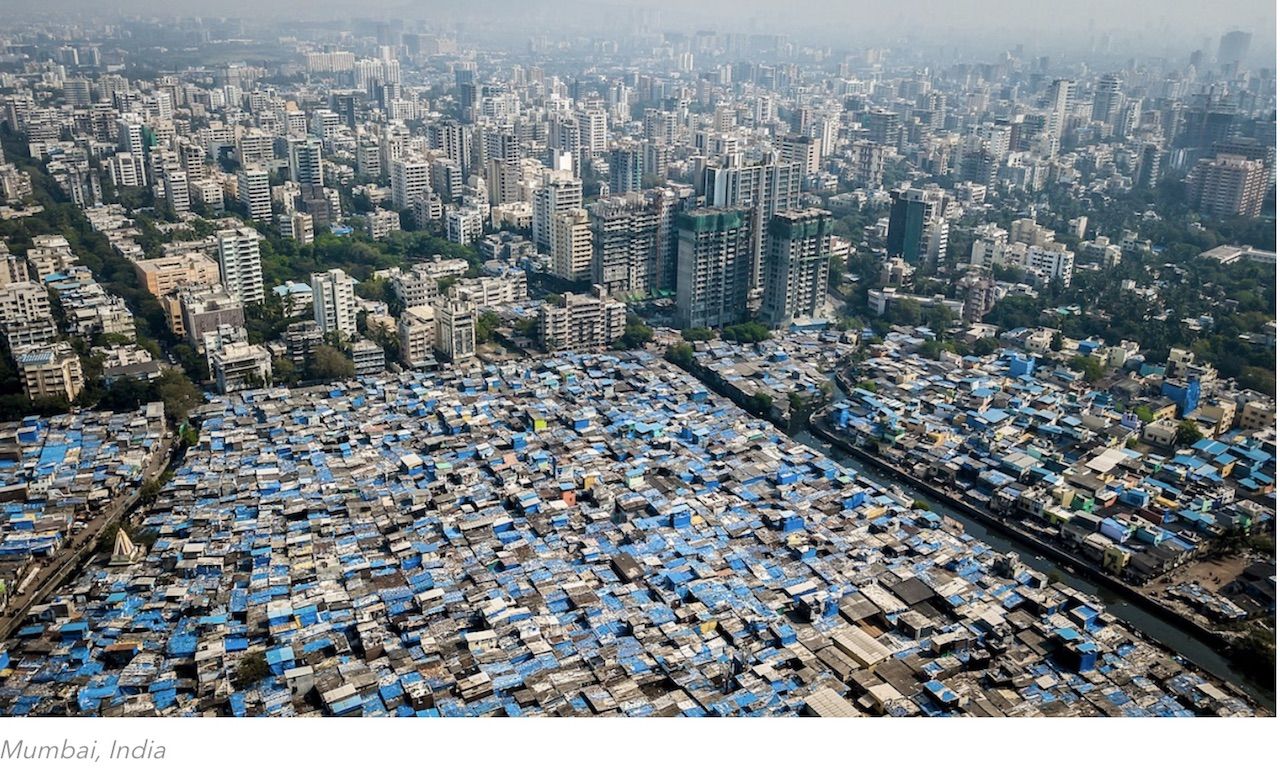
matadornetwork.com | Photo: Johnny Miller/Unequal Scenes
Storytelling Through Digital Mapping
At its core, digital mapping offers nonprofits the opportunity to tell their story in ways that each of their stakeholders can more easily appreciate. Maps simply play a big role in getting the point across and showing relevance as to why the story is important to its beneficiaries.
Check out Esri Story Maps, a web tool that combines the power of maps and narrative text to create engaging and inspiring stories to share with others. Besides maps, your stories can include places, locations, and geography. You can embed a wide variety of multimedia materials to tell your stories. These include videos, images, texts, shapes and many more.